


TRENT HILLS, ONTARIO — What’s unfolding along the Trent River this week is a familiar but uneasy spring ritual — one that residents know well, yet never take lightly.
As of Friday, April 16, 2026, water levels continue to climb steadily through communities like Campbellford and Hastings, driven by melting snowpack upstream and compounded by days of persistent rain. What makes this year particularly concerning is not just how quickly the river is rising — but how much more water is still expected.
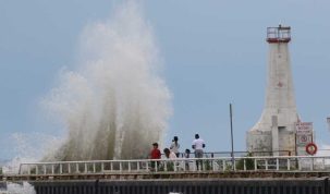
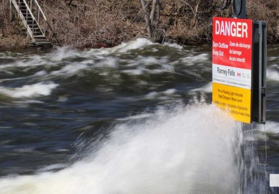
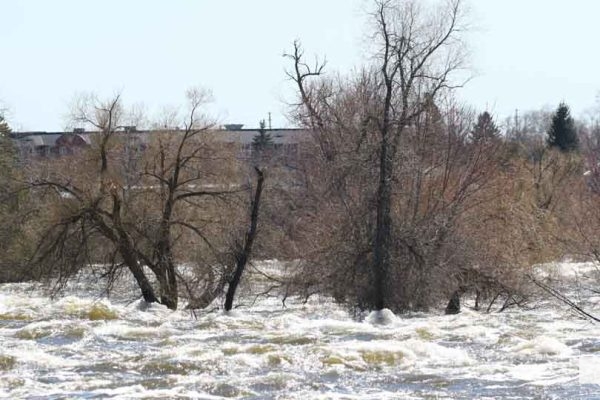
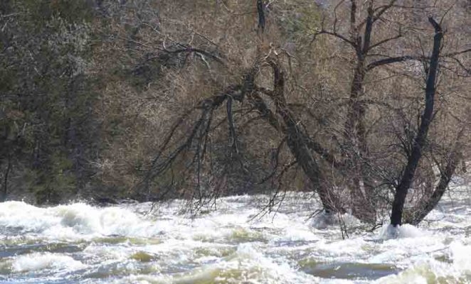
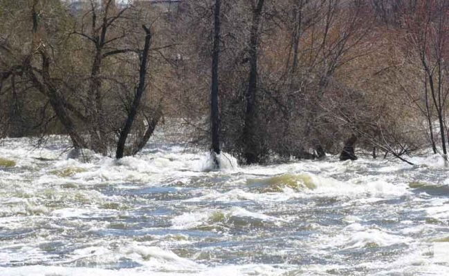
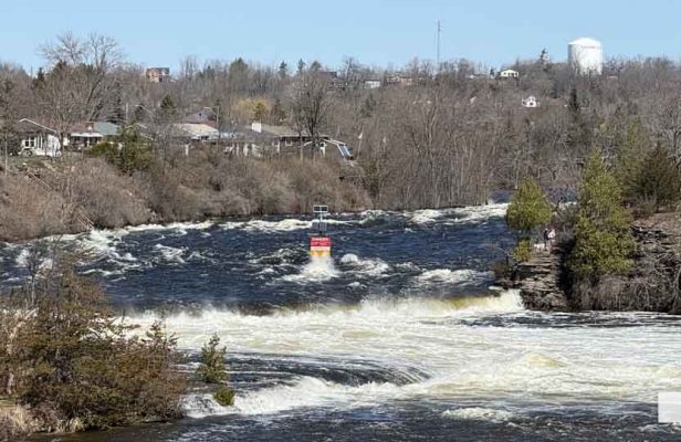
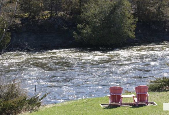
Through the scenic but narrow Ranney Gorge in Campbellford, the river has transformed into a fast-moving torrent. The usual calm flow has been replaced by churning, powerful currents, drawing residents and visitors to the banks to witness the force of nature up close.
Flood Warning in Effect
The Lower Trent Conservation has issued a flood warning covering a wide stretch of the watershed, including the municipalities of Brighton, Quinte West, Stirling-Rawdon, Trent Hills, and Alnwick-Haldimand, as well as Northumberland and Hastings counties.
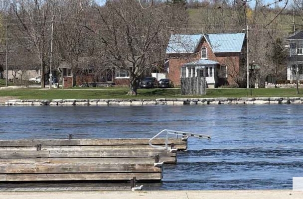
The warning includes Rice Lake and the Trent River corridor from Hastings to Trenton, where rising water levels and strong currents are creating hazardous conditions.
Officials are urging caution, noting that unstable banks, fast-moving water, and hidden debris can pose serious risks — not only to recreational users like boaters and anglers, but also to waterfront property owners attempting to protect their homes.
A Watershed Under Pressure
The entire Trent system is now in what’s known as the spring freshet — the annual surge of water caused by melting snow and seasonal rains.
This year, that surge is being amplified.
Water flowing into the Trent River originates from a vast watershed stretching north into the Haliburton highlands, feeding through reservoir lakes and into the Kawartha Lakes before moving down through the Otonabee River and into Rice Lake.
Each part of that system is contributing to the rising levels now being seen downstream.
Compounding the situation is the forecast: 15–20 mm of additional rainfall over the next five days, with localized thunderstorms potentially pushing totals closer to 30 mm. With the ground already saturated from weeks of precipitation, much of that water is expected to run directly into rivers and streams rather than being absorbed.
“It’s a Wait and See Game”
For emergency services, the situation is being closely monitored — but remains unpredictable.
Trent Hills Fire Chief Shawn Jamieson says the municipality is taking a measured approach.
“It’s a seasonal thing — it pretty much happens every year. It’s just to what degree.”
While current levels were slightly below those seen at the peak of last year’s flooding, Jamieson cautioned that comparisons can change quickly.
“That could change over the next few days.”
With rain expected to continue into the weekend, municipal crews are assessing conditions daily, responding where needed and preparing for the possibility of more significant impacts.
“We’re taking it day by day. It all depends on the weather — and there are so many different factors.”
Local Impact Already Being Felt
Across Trent Hills, signs of flooding are becoming increasingly visible.
Fields are saturated, with standing water stretching across large areas — a result of steady rainfall over the past two weeks. That excess water is now feeding into the river system, adding to already elevated flows.
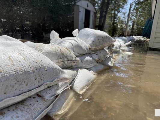
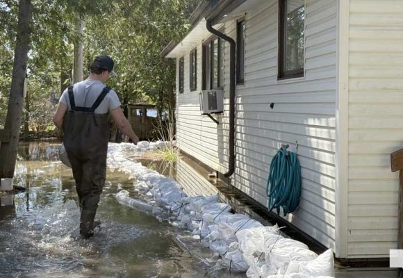
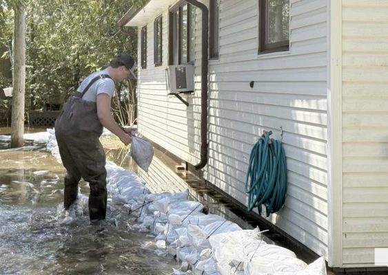
In some areas, the river has begun to encroach on residential properties.
On Cedar Drive in Hastings, at least two homes were already surrounded by water by Friday, with swift currents moving dangerously close to structures.
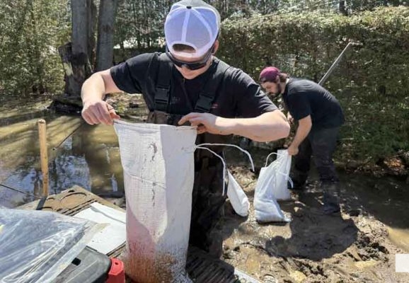
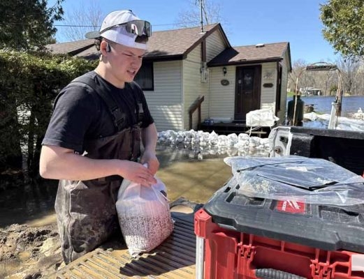
Residents and contractors have been working against the clock to limit the damage.
Carson Morris, owner of Innovation Landscaping, was among those on-site, helping to build sandbag barriers around a home threatened by rising water.
“I’ve lived in the area for nearly 10 years, and this is reaching the highest level it got last year — and it’s expected to go higher.”
What concerns Morris most is not where the water is now — but where it’s heading.
“From what they’re predicting, it’s supposed to get an inch more every day. So for the next nine to 10 days, we’re supposed to get more rain.”
He notes that while the river has already reached levels comparable to last year’s peak, the current situation is far from over.
“This is about where it got at the end of last year, but now it’s not even close to the end of what we’re dealing with.”
Race Against Time
For many residents, preparation can make the difference — but timing is everything.
Morris says his crew has been responding to calls, often with little notice.
“We try to help everyone we can, but sometimes we get called at the last minute.”
His advice is simple but critical:
“Always keep an eye on the weather and always stay prepared.”
That message is being echoed by local officials.
Support for Residents
The Municipality of Trent Hills is providing sandbags and zip ties to residents looking to protect their properties. Officials are encouraging anyone in need to contact the municipal office as soon as possible rather than waiting until water levels become critical.
With river levels continuing to rise, access to some properties may become more difficult in the coming days.
Watching the Forecast
For now, the story along the Trent River remains one of uncertainty.
Every rainfall, every degree of warming temperature, and every upstream inflow has the potential to influence what happens next. While the situation has not yet reached the severity of previous years, the margin is narrowing.
Residents, emergency crews, and local officials are all watching closely — balancing preparation with patience.
Because in a spring like this, along a river as vast and interconnected as the Trent, there is only so much that can be controlled.
And for now, it remains exactly what many are calling it:
A waiting game.

Author: Pete Fisher
Has been a photojournalist for over 30-years and have been honoured to win numerous awards for photography and writing over the years. Best selling author for the book Highway of Heroes - True Patriot Love