

(Today’s Northumberland file photo)
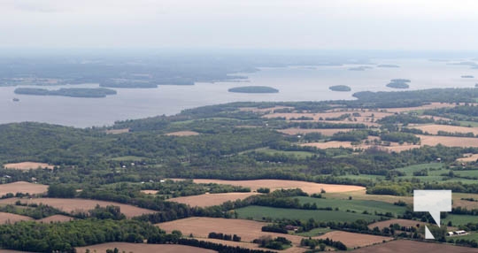
The Ganaraska Region Conservation Authority advises that the water level on Rice Lake is rising and may reach levels capable of flooding shorelines over the next several days. Runoff from heavy rains and snowmelt is making its way through the larger Trent River watershed, which includes the Haliburton tributaries, reservoir lakes, the Kawartha Lakes and the Otonabee River.
All the lakes in the watershed, including Rice Lake are experiencing above average water levels and are expected to continue increasing for the next several days. Rice Lake is currently at 187.0 meters above sea level (masl) and rising at a rate of between 3 and 5 cm per day. During the flood event of 2014, the Rice Lake water level reach 187.43 masl at its peak.
Weather forecasts indicate that a low-pressure system is expected to move into the province on Friday and Saturday bringing another 10 to 15 mm of rain for the Rice Lake area. This will likely prolong the high water levels well into next week for Rice Lake. During this time, wave action could lead to erosion particularly on windy days. Areas of the shoreline that have flooded in the past, should prepare for water levels like what was experienced in 2014 and 2019.
This message applies to the Rice Lake shoreline only. The forecasted rainfall will cause an increase in local stream levels and flows; however no flooding is anticipated on the smaller streams in the area.
This Flood Warning for the shoreline of Rice Lake within the Ganaraska region will be in effect through Friday, April 11th, 2025. Conservation Authority staff will continue to monitor conditions and provide updates as necessary. Should you have any questions or wish to report flooding, please contact the following GRCA staff at 905-885-8173.

Author: Pete Fisher
Has been a photojournalist for over 30-years and have been honoured to win numerous awards for photography and writing over the years. Best selling author for the book Highway of Heroes - True Patriot Love