
A Flood Outlook Statement is issued to raise awareness. Based on weather forecasts for heavy rain, snowmelt or high wind, a change in conditions on local waterways is possible.
Lower Trent Conservation advises local municipalities and the public that a Flood Outlook Statement has been issued for Lake Ontario and Bay of Quinte shoreline from Grafton to Quinte West.
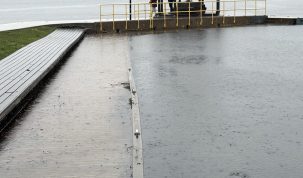
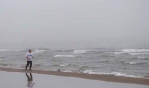
Residents along the shoreline should be aware of the potential for erosion and flooding.
Higher than normal water levels have continued on Lake Ontario throughout the fall and winter. Unprecedented inflows into Lake Ontario have kept these water levels elevated over the past few months and the Lake Ontario water level at the Cobourg gauge is currently 75.16 m (IGLD85).
The water levels are currently 51 cm above average for this time of year and are only 14 cm below the record high for the time of year set in 1952. The International Lake Ontario – St. Lawrence River Board has forecasted that if the weather conditions continue within normal ranges for this time of year, the water levels are predicted to reach 75.3 m (IGLD85) by the week of April 10 and reach peak levels in mid-May around 75.45 m (IGLD85).
This is well below the peak water level of 75.88 m seen in 2017 and 75.92 m observed in 2019.
High onshore winds may also result in greater short-term fluctuations of water levels, as well as increased flooding and erosion. High winds are predicted for later today so shoreline landowners should be aware of the potential for increased wave action and additional erosion.
Water levels on the Great Lakes naturally vary, responding monthly, seasonally and annually to a variety of factors. Water levels are primarily influenced by natural factors, including precipitation, evaporation, winds, runoff from rivers or streams and inflow from upstream Great Lakes. Lake Ontario typically reaches its seasonal high water level in May/June. Residents living along Lake Ontario and the Bay of Quinte should expect further increases in water levels for at least the next couple of months.
For further information on Lake Ontario water levels and forecasted water levels, please visit the International Lake Ontario-St. Lawrence River Board website:
https://ijc.org/en/loslrb/watershed/water-levels
Residents should ensure personal property (boats, docks, etc.) along the shoreline is secured. Property owners are also reminded that any work along the shoreline (e.g., place of fill, armour stone, etc.) will require a permit from Lower Trent Conservation and should call the office or visit the website for more information.
Lower Trent Conservation monitors water levels and weather forecasts closely as part of its flood forecasting and warning program. Daily water level updates are available at www.LTC.on.ca. If you have concerns about water levels, please contact Lower Trent Conservation at (613) 394-4829.
This Flood Outlook Statement will be in effect until (or updated before) Thursday, April 9, 2020.

Author: Pete Fisher
Has been a photojournalist for over 30-years and have been honoured to win numerous awards for photography and writing over the years. Best selling author for the book Highway of Heroes - True Patriot Love