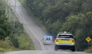


Lower Trent Conservation advises municipalities and the public that a Flood Watch, issued Thursday, April 12, 2018, remains in effect for the Lower Trent Conservation watershed region (area stretching from Grafton to Quinte West and from Lake Ontario to Rice Lake).
The weather system moving through the region has resulted in approximately 70 millimetres of mixed precipitation over the weekend. An additional 20 to 35 millimetres of precipitation is forecast for today.
Water levels on many local creeks and streams, including Mayhew, Cold, Rawdon, Burnley, Trout, Smithfield, Butler, Salt, Colborne, and Shelter Valley Creeks are reaching top of bank conditions. The forecast precipitation will result in further increases in levels on these watercourses, which could be sharply elevated with runoff from today’s additional rain and ice/snow melt. There continues to be a risk for flooding of access roads, backyards or basements in low-lying areas.
Flows and water levels on the Trent River continue to increase as Parks Canada – Ontario Waterways (Trent-Severn Waterway) makes adjustments at water control structures to accommodate the increased runoff. With warmer temperatures anticipated later this week, the snow pack in the northern portion of the Trent River watershed will start to melt and result in further increases in water levels and flows along the Trent River from Hastings to Trenton. Residents should ensure their sump pumps are working and secure personal property (boats, docks, etc.) along the river banks.
Lower Trent Conservation is maintaining daily contact with the Parks Canada, provincial Surface Water Monitoring Centre, and neighbouring Conservation Authorities to ensure we are aware of all dam operations and conditions that may affect water levels along local waterways.
The public is urged to use extreme caution around all watercourses due to strong currents, cold water temperatures, and slippery stream banks. Parents and caregivers are advised to keep children away from all waterways. Areas around dams, culverts and bridges should be avoided at all times.
This Flood Watch will be in effect until Wednesday, April 18, 2018 and will be updated earlier if conditions warrant.
Lower Trent Conservation monitors water levels and weather forecasts closely as part of its flood forecasting and warning program. Daily water level updates are available at www.ltc.on.ca. If you have concerns about water levels, please contact Lower Trent Conservation at (613) 394-4829.

Author: Pete Fisher
Has been a photojournalist for over 30-years and have been honoured to win numerous awards for photography and writing over the years. Best selling author for the book Highway of Heroes - True Patriot Love